
Bristol City Council’s South Bristol Liveable Neighbourhoods team has released details of its revised proposals. Those specifically relating to Totterdown are reproduced below.
A link to the Council’s website with the full information is here: https://www.bristol.gov.uk/ask/projects/south-bristol-liveable-neighbourhood/sbln-proposals-2026
Revised plans for Totterdown
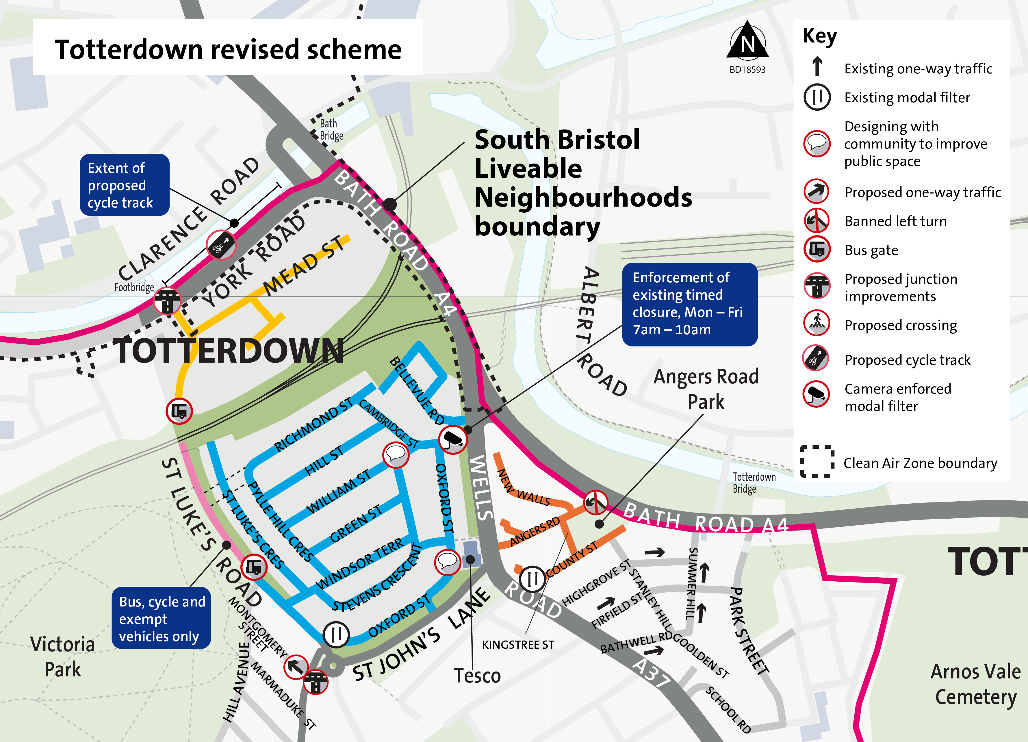 Larger version of map
The 2025 consultation told us local people were concerned by the one-way and direction changes. As a result, we are not bringing forward these changes.
Concerns were also raised about supporting access to the Bristol Jamia Mosque on Green Street while tackling local parking pressure. This will be addressed through proposals for a Residents’ Parking Scheme.
Main changes to proposals for Totterdown include:
- Dropping plans for one-ways across the area
- Moving the proposed bus gate on St Lukes Road to just north of the Hill View junction and adding 4 bus stops for the number 16 bus
- Installing a camera to enforce a timed morning closure on Cambridge Street onto Bellevue Road
- Exploring options with residents and businesses to improve a small section of William Street
- Retaining plans for a banned left turn from Bath Road into Angers Road
- Retaining plans to work with businesses and residents in the area to design new public spaces on a section of Oxford Street next Totterdown Square
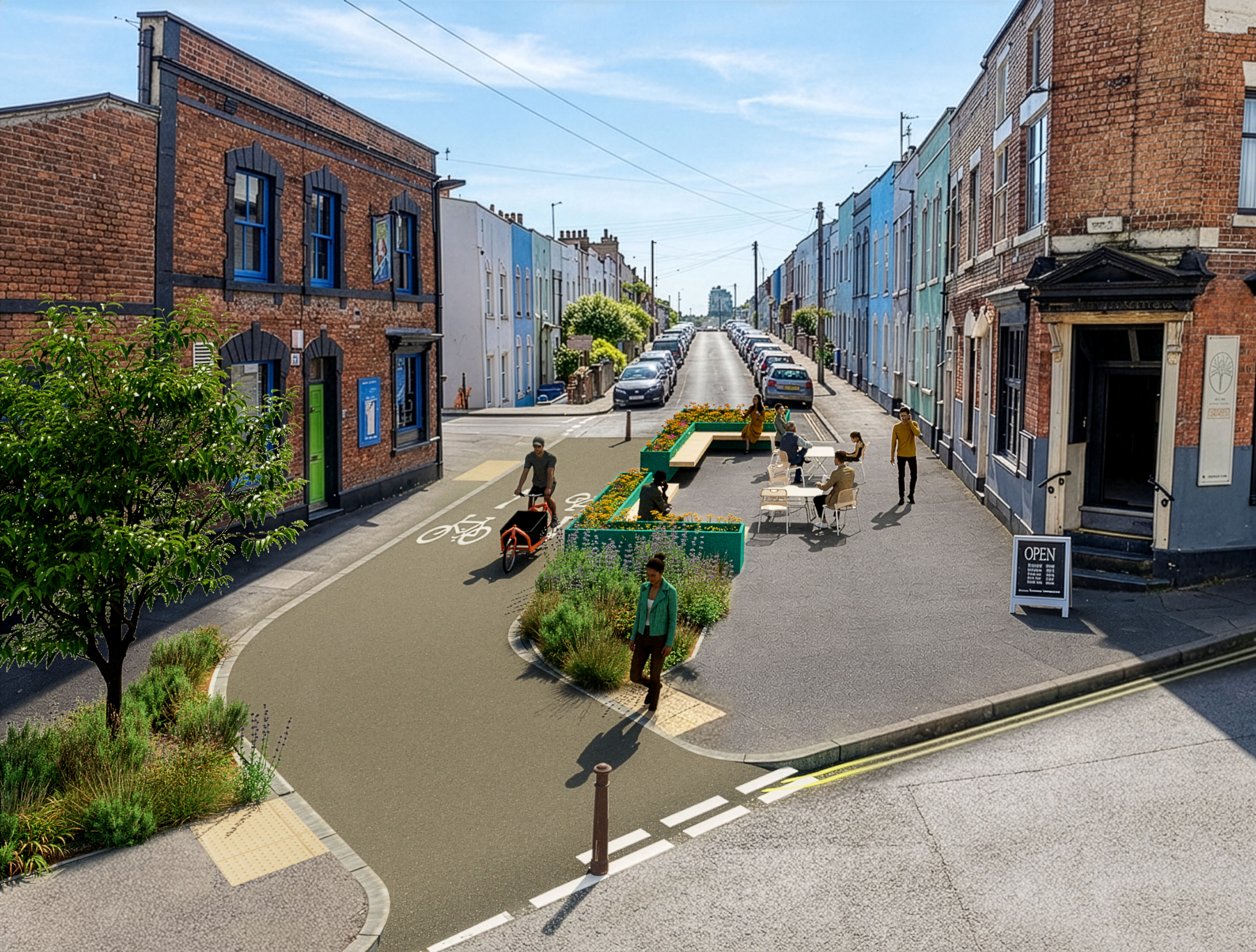 William Street visualisation of a potential option subject to further community engagement
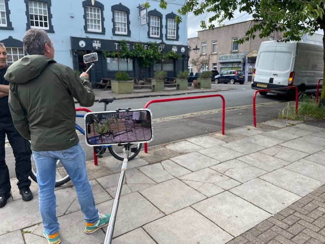
Local residents and business owners came together in Summer 2026 to reimagine public spaces in workshops run by Future Places Toolkit
Designs for a section of Oxford Street, next to what is known locally as Totterdown Square, and William Street are being shaped through a collaborative engagement process.
As part of this we have hosted a series of ‘co-design’ workshops and discussions with residents, local businesses and community stakeholders, where participants were able to share their experiences, identify local priorities, and contribute ideas for the future of the square.
Active Travel Routes
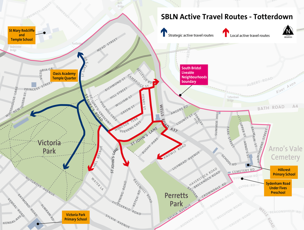
Our updated plans create a network of quiet and accessible routes for walking, wheeling and cycling. These routes are enabled by introducing the modal filters that reduce the volume and speed of traffic, making it safer and more attractive to walk, wheel and cycle.
We’re focussing improvements along key streets to connect neighbourhoods, make it safer to travel actively to school and use a wheelchair or push a pram.
Plans include adding:
- dropped kerbs
- tactile paving
- better crossings
- wayfinding to connect to local places and further afield
Parking measures
In 2025 we proposed 11 parking areas with either a Residents’ Parking Scheme (RPS) or a Matchday Parking Scheme (MPS).
Revised plans for parking measures
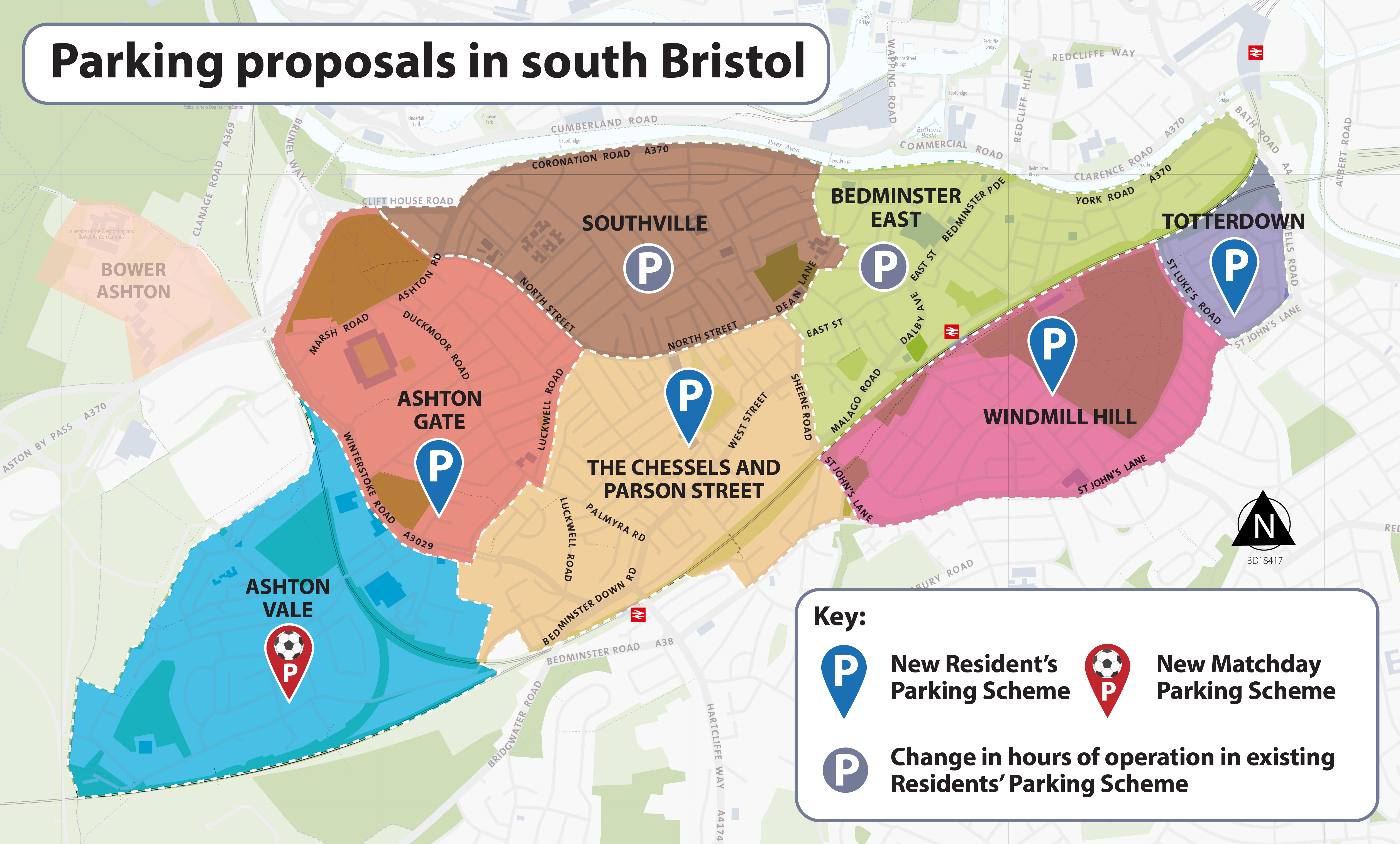
Parking plays an important role in supporting safer, more liveable neighbourhoods as the city continues to grow and change.
We are taking a targeted approach to Residents’ Parking Schemes (RPS), focusing on areas where support is higher and clear evidence of parking pressures.
Responding to feedback, our plans now include:
- Taking forward Residents’ Parking Schemes in Totterdown, Windmill Hill, The Chessels and Parson Street, and Ashton Gate
- Reducing the area included in the Totterdown scheme and expanding the area included in the Windmill Hill scheme
There will be local consultations on each of these parking schemes.
Sign up to the newsletter to keep up to date on the proposals.
On residential streets we also proposed measures to improve community space, including adding:
- street trees and planting
- visitor cycle parking
- cycle hangars
- electric vehicle (EV) lamppost chargers
- car club bays
- e-scooter and e-bike share parking areas
Some of these improvements will be delivered alongside Residents’ Parking Schemes, helping to balance how on-street space is used. This will make sure there is room for people who need to park vehicles and bicycles while creating greener, more attractive community-friendly streets.
Delivering them alongside each other in this way means changes can be coordinated and introduced at the same time.
Exact locations for some of these measures will be finalised once we’ve carried out surveys of underground utilities, such as gas, water and telecoms, because this can affect where we place things like trees.
What’s next
Some early work is set to get underway in the coming months. This includes… installing around 20 cycle hangars across the wider SBLN area, which covers all three BS3 wards.
Transport and Connectivity Committee will consider the next steps for the main SBLN scheme in December. If approved, a full business case will be submitted to the West of England Mayoral Combined Authority to seek the funding to build the scheme.
There would also be statutory consultations for the Traffic Regulation Order-dependent elements of the scheme early in 2027 before any permanent changes are made. This would offer a further opportunity to support or object to specific changes to roads, such as traffic filtering measures, changes to the direction of traffic, and the bus gate.